Trending
Maps and images expose extent of Los Angeles wildfire destruction
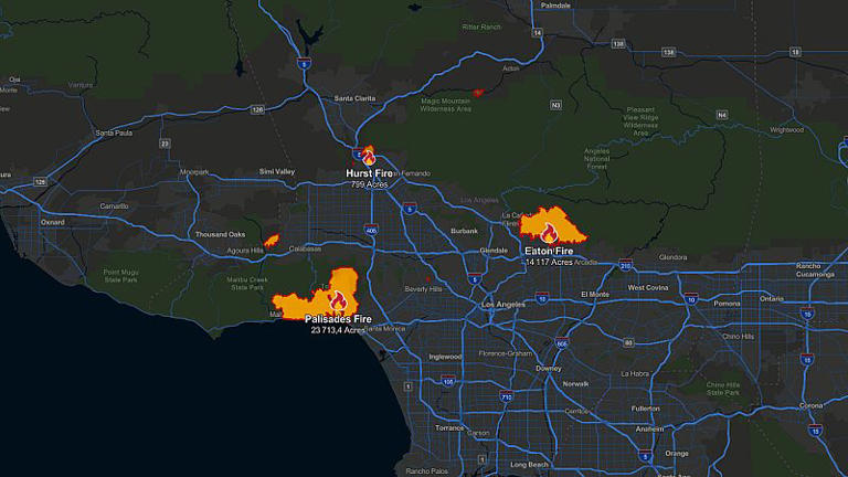
Fires tearing through the Los Angeles area have killed at least 24 people, displaced thousands of others and destroyed more than 12,000 structures while burning through an area larger than San Francisco.
These maps and images illustrate the immense scale of the challenge, highlighting where the fires are raging and the devastation they have left behind.
The largest blaze, located in the Pacific Palisades area, has become the most destructive wildfire in Los Angeles history, with over 23,000 acres already scorched.
The dramatic level of destruction in some places was evident in a comparison of satellite images taken before and after the fire.
A swath of about 250 homes in an Altadena neighborhood, dotted with the green canopies of leafy trees and aquamarine swimming pools, was reduced to rubble.
Only a few homes were left standing in the images provided by Maxar Technologies.
As the fires continue to rage in some areas, the Wildland Fire Interagency Geospatial Services Group provides updates on active and recent incidents, using satellite-based detection systems.
The maps below show areas where burning activity was identified within the past 24 hours.
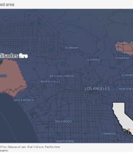
The number of people officials have told to evacuate has dropped in recent days, but authorities cautioned that more evacuations could be ordered when high winds return this week.
Additional fires are possible, and the wind could spread the ongoing fires. So officials urge residents to be prepared to evacuate if needed and make a plan for their families.
Even after an evacuation order is lifted, it still might not be safe to return home due to damaged gas and electric lines and other hazards.
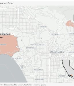
The number of people under evacuation orders in Los Angeles County has dropped to under 100,000 by Monday, 13 January.
Most of the destruction has been from the Eaton Fire near Pasadena and the Palisades Fire, in a wealthy enclave along the Pacific Coast. Firefighters have made progress on both fronts in recent days, with the Eaton Fire roughly one-third contained.
In California, record-breaking fires in 2017 and 2018 destroyed communities and damaged or destroyed thousands of structures. According to reports and statistics, California’s 20 most destructive wildfires, measured in terms of structures burned, have occurred between 2015-2025.
Trending
“It took me getting married and giving birth to realise marriage benefits men more” — Woman shares emotional thoughts

A woman has stirred serious conversations online after opening up about how marriage and motherhood changed her perspective on life.
In a heartfelt reflection, she said it was only after getting married and giving birth that she began questioning who marriage truly benefits.
According to her, women often carry the heavier load — emotionally, physically, and mentally.
She explained that marriage can make women feel like tools, responsible for cooking, cleaning, caring for the home, and even contributing financially, while still bearing the full weight of pregnancy, childbirth, and childcare.
She questioned why something described as a “blessing” should come with so much pain, stress, sleepless nights, and emotional strain for women.
In her words, childbirth comes with intense pain, followed by years of responsibility that largely fall on the woman, while many men continue life almost unchanged.
She admitted she never strongly pushed for marriage herself and only went along with it after family pressure. It was the lived experience — not theory — that opened her eyes.
While she made it clear that she loves her son deeply and finds joy in him, she said motherhood also forced her to confront uncomfortable truths about expectations placed on women.
📹: TT/mummychika1
https://www.instagram.com/reel/DSP0XSnjAvd/?igsh=MTd3ZzdlbWI0dHV1Nw==
Trending
Private jet crash lands at Kano airport
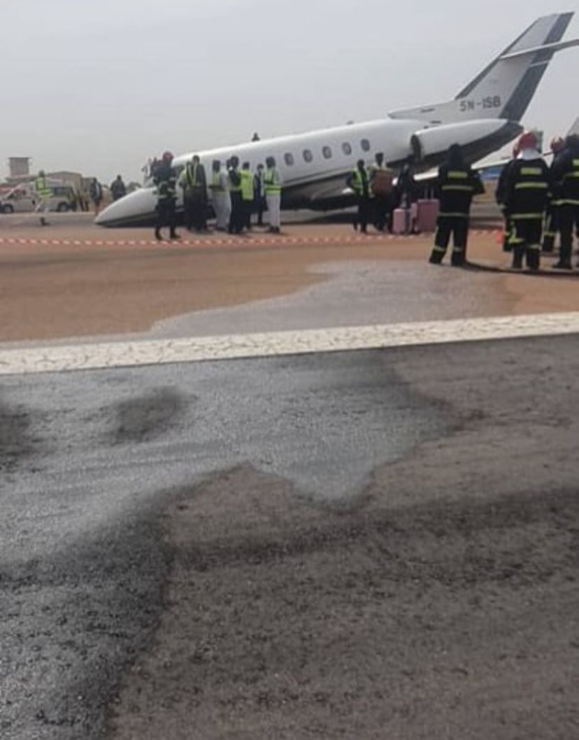
A jet operated by Flybird Airlines has crash-landed at the Mallam Aminu Kano International Airport (MAKIA), Kano, causing panic among airport users and sending shockwaves through the aviation community.
An eyewitness stated that the aircraft, which arrived from Abuja, was carrying 11 occupants, including three crew members, when the incident occurred at about 9:30 a.m. on Sunday, December 14, 2025.
According to the accounts, the jet experienced difficulties on landing and crash-landed on the runway, leading to tense moments as passengers were quickly evacuated from the aircraft.
All occupants were safely evacuated, with no immediate reports of injuries or casualties.
Airport authorities were said to have promptly secured the scene, while emergency response teams were deployed to prevent further danger and ensure the safety of passengers and airport personnel.
Operations around the affected area were temporarily restricted as officials began preliminary assessments.
As of the time of filing this report, the cause of the crash-landing had not been officially determined, while aviation authorities were expected to commence a full investigation into the incident.
https://www.instagram.com/p/DSP6bFqjC2v/?igsh=MWQ1bmk0NTI2Zng2
Trending
One of the gunmen who opened fire on innocent civilians observing Hanukkah at Bondi Beach has been identified as Naveed Akram.

One of the gunmen who opened fire on innocent civilians observing Hanukkah at Bondi Beach has been identified as Naveed Akram.
On of the suspects was disarmed by a bystander and it’s been gathered that the police have arrested one of the suspects.
NB: This page does not support violence and this is just a news report for awareness.

-
Business1 year ago
US court acquits Air Peace boss, slams Mayfield $4000 fine
-

 Trending1 year ago
NYA demands release of ‘abducted’ Imo chairman, preaches good governance
-

 Politics1 year ago
Mexico’s new president causes concern just weeks before the US elections
-

 Politics1 year ago
Putin invites 20 world leaders
-

 Politics1 year ago
Russia bans imports of agro-products from Kazakhstan after refusal to join BRICS
-
Entertainment1 year ago
Bobrisky falls ill in police custody, rushed to hospital
-
Entertainment1 year ago
Bobrisky transferred from Immigration to FCID, spends night behind bars
-
Education1 year ago
GOVERNOR FUBARA APPOINTS COUNCIL MEMBERS FOR KEN SARO-WIWA POLYTECHNIC BORI


